
Introduction
Drones in Agriculture Since the plow was invented and modern technology was first used, agriculture has consistently been at the vanguard of technical progress. The introduction of drone technology has brought about yet another revolutionary change in the agricultural sector. Unmanned aerial vehicles (UAVs), more often known as drones, are changing the game for crop management. Drones have many uses in agriculture, but this essay will concentrate on how they might improve crop management and monitoring.
How Agrarian Technology Has Developed Over Time
From crude implements to the complex machinery of today, agricultural technology has come a long way. It took a lot of time and effort to get consistent results using traditional farming methods. Farming became more efficient and productive with the advent of automated equipment during the industrial revolution. Nevertheless, farmers continued to have difficulties in efficiently managing vast fields and precisely monitoring crop health despite these developments.
Precision agriculture arose in response to the proliferation of digital technologies with the goal of improving crop farming management at the field level. Data collection and analysis play a crucial role in precision agriculture for making educated decisions. By delivering high-resolution aerial imagery and real-time data collecting, drones bring a new dimension to agricultural activities.
An Overview of Agrarian Drones
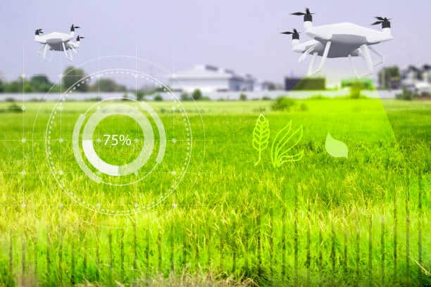
The military, entertainment industry, and logistics are just a few of the many fields that have made extensive use of drones. Although they are still in their infancy, their use in farming is expanding at a rapid pace. Thanks to the sophisticated sensors and imaging capabilities of agricultural drones, farmers can now survey their crops from above. When compared to more conventional methods of ground observation, the insights provided by this flying viewpoint are far superior.
Due to their adaptability, drones can carry out a broad variety of operations, from basic visual inspections to intricate data analysis. Because of their speed and efficiency, they are perfect for use in contemporary farming. With the constant advancement of technology, the price of drones is dropping, allowing farmers of all sizes to afford them.
The Use of Drones in Farming and Their Advantages
Drones have many uses in agriculture, one of which is to improve crop management and observation. The capacity to collect data in real-time is one of the biggest benefits. There are frequency and resolution limits to traditional crop monitoring methods like satellite photography and physical scouting. Whenever it’s necessary, drones may fly over fields to take high-resolution pictures that reveal everything about the crop’s health.
Cutting down on work and time is another big perk. It can take days—if not weeks—of laborious manual monitoring to cover big fields. Drones can accomplish the same thing much more quickly, freeing up farmers to tend to other pressing matters. Saving money and getting more done are the results of this efficiency.
Sustainable farming methods are enhanced by drones as well. More precise and targeted application of water, fertilizer, and pesticides is possible when farmers have access to accurate data on crop health, soil conditions, and insect infestations. This methodical strategy encourages resource efficiency while decreasing waste and negative effects on the environment.
Optimizing Farming Using Drones
An approach to agricultural management known as “precision agriculture” centers on tracking and reacting to variations in crop yields both within and between fields. An integral part of this strategy, drones give farmers access to comprehensive data that improves their decision-making. Drones can take high-resolution pictures that can be used to make precise maps of soil conditions, crop health, and other important data.
Variable rate application (VRA) is a critical use case for drones in precision farming. Virtual reality agriculture (VRA) entails distributing seeds, fertilizer, and pesticide at variable rates across a field according to the unique requirements of each area. Farmers may efficiently apply VRA with the help of drones equipped with multispectral sensors, which can detect differences in crop health and soil parameters. Optimal input use, higher agricultural yields, and lower costs are the results.
Drones also make it easier to regulate irrigation systems precisely. Farmers can find out which parts of the field need more or less water by looking at aerial photos. With this data, irrigation systems can be better planned to save water waste while also promoting consistent crop development.
Monitoring the Health of Crops
Achieving good yields and guaranteeing food security requires vigilant monitoring of crop health. In order to detect problems like nutrient shortages, illnesses, and insect infestations early on, drones fitted with a variety of sensors can track crop health in real-time. The health of crops can be best assessed with the help of thermal imaging sensors and multispectral imaging sensors.
Sensors that are able to detect light at a variety of wavelengths, including some that are invisible to the naked eye, are known as multispectral. This makes it possible to identify stress signs that are invisible to the human eye. A stressed plant, on the other hand, will reflect less near-infrared light than a healthy one. Farmers may detect stressed plants early by studying multispectral photos, allowing them to take corrective actions before the problem spreads.
Infrared thermal imaging sensors can pick up on changes in ambient temperature. Plants that experience temperature changes may be suffering from water stress or an illness. Farmers can quickly fix problems by finding areas of high or low temperature in the field, which allows them to cultivate crops in the best possible conditions.
Assessment and Control of Soil
Maintaining healthy soil is essential for harvesting crops. Soil sampling using traditional methods is laborious and yields imprecise results in terms of spatial resolution. Drones can examine soil conditions more quickly and thoroughly than any other method. Drones equipped with sensors may evaluate organic matter, soil texture, and moisture content, among other soil parameters.
By gliding over the field and gathering data on soil parameters, drones can carry out soil mapping. Detailed maps that show how soil qualities vary are made using this data. Soil management activities like tillage, irrigation, and fertilization can be better planned with the help of these maps.
Drones also have an important role to play in soil moisture monitoring. You can’t have healthy crops without correct irrigation, and you can lose a lot of production if you over-or under-irrigate. Farmers can improve irrigation schedules and preserve water with the help of drones outfitted with thermal sensors, which detect soil moisture levels across the field.
Disease and Pest Control
Significant risks to crop output come from pests and illnesses. In order to limit damage and stop infestations from spreading, early discovery and prompt action are vital. With the help of drones, farmers can keep an eye on their crops for any indications of pests or diseases so they may take preventative actions.
Small changes in crop health, picked up by drones with high-resolution cameras and multispectral sensors, might mean disease or insect infestation. As an example, aerial photography can reveal the patterns of damage that particular pests inflict on foliage. Farmers may use these photos to identify problem regions and treat them specifically, cutting down on the use of broad-spectrum pesticides.
Drones also have the potential to track how well pesticides are working. Drones can examine the field’s impact and determine if more action is needed once remedies are applied. The effectiveness and sustainability of pest and disease management systems are guaranteed by this constant monitoring.
Predicting and Estimating Yield
In order to make informed decisions and plans, precise yield assessment is crucial in agriculture. Methods like statistical models and manual sampling that have been used for yield estimation in the past tend to be labor-intensive and inaccurate. Drones offer a more precise and time-saving approach to estimating harvest yields.
Drones may study yield-related factors like crop density and plant height by taking high-resolution pictures of the field. This data is processed by advanced algorithms to produce yield estimations that are accurate. Farmers rely on these estimations for a variety of tasks, including labor management, marketing, and harvest scheduling.
Another important use of drones in supply chain management and market planning is yield forecasting. Drones offer useful data for predicting harvest yields by tracking crop development and health throughout the growing season. Farmers and stakeholders can use this data to make better storage, shipping, and sales decisions.
Obstacles and Restrictions

While there are many advantages to using drones in farming, there are also some disadvantages and restrictions. The high starting price for drone technology and ongoing maintenance is one of the main obstacles. Drones in general have become more affordable, but high-end agricultural drones with sophisticated sensors and imaging capabilities can still break the bank. Training employees to fly drones and understand the data they gather also adds to the price tag.
The regulatory landscape is another constraint. The rules that aviation authorities establish for drone flights can differ greatly from one country to another. There may be limitations on the height, distance, and locations where drones can be flown; farmers must adhere to these rules. It might take a lot of time and effort to navigate these regulations.
Another obstacle is data management. Data processing and analysis are necessary due to the massive amounts of data produced by drones. To accomplish this, reliable data management systems and trained employees are needed to glean useful information from the data. Integrating drone data with other farm management tools is also important for farmers to make educated decisions.
Innovations and Future Outlook
The use of drones in farming still has a ways to go, but the future is bright. Drones are already available to farmers, but their possibilities will only grow as data analytics and drone technology continue to progress. In order to enhance data analysis and decision-making, drone technology is being merged with innovations like artificial intelligence (AI) and machine learning (ML).
Predictions on crop health, soil conditions, and insect infestations can be made by analyzing drone data with AI and ML algorithms. Additionally, these technologies have the ability to automate data processing, which speeds up decision-making by decreasing the need for human participation.
Drone integration with other technologies, including the IoT and satellite images, is another intriguing prospect. Drone footage can be supplemented with data collected by Internet of Things (IoT) devices like weather stations and soil moisture sensors. By merging these datasets, we can get a clearer picture of the field and make better decisions about crop management and monitoring.
In summary
By giving farmers access to strong tools for crop management and monitoring, drones are revolutionizing agriculture. More effective agricultural methods and better decision-making are possible with the use of high-resolution aerial photography and real-time data. Drones have many uses that improve agricultural output and sustainability, including precision farming, soil analysis, pest control, and yield estimation.
Constant improvements in data analytics and technological capabilities should eventually resolve concerns like expense, rules, and data management. Drones are already having a significant impact on agriculture, and their integration with other technology will further increase their influence. This will allow farmers to sustainably satisfy the rising demand for food.